

Railways, Waterways, and Walkways
Historical photographs and maps related to our Saturday, May 19, walk from the Glendale Transportation Center to L.A. State Historic Park
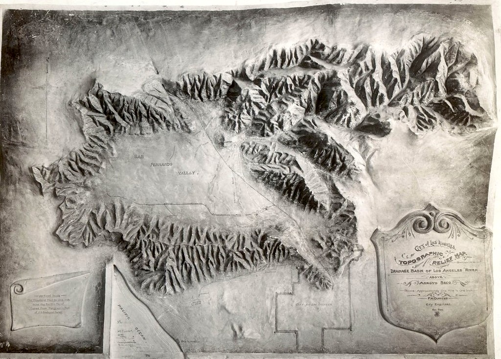
1. Topographic relief map of Los Angeles showing the narrow passage (bottom right) that connects the San Fernando Valley and the L.A. basin, 1912
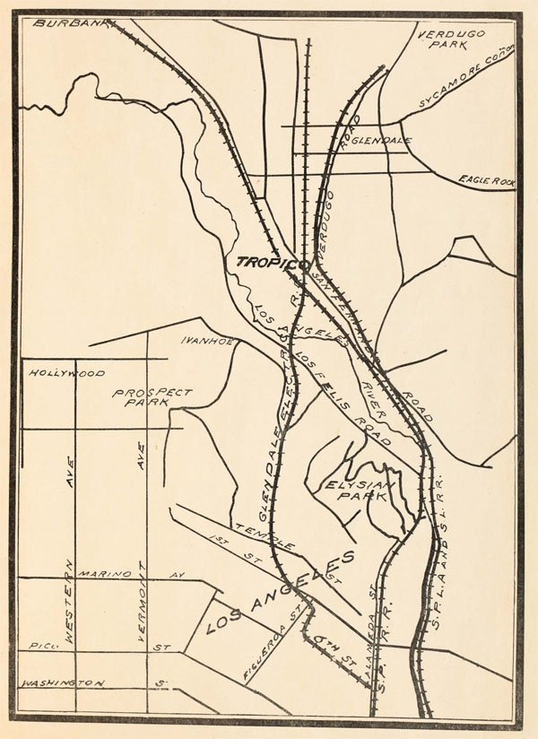
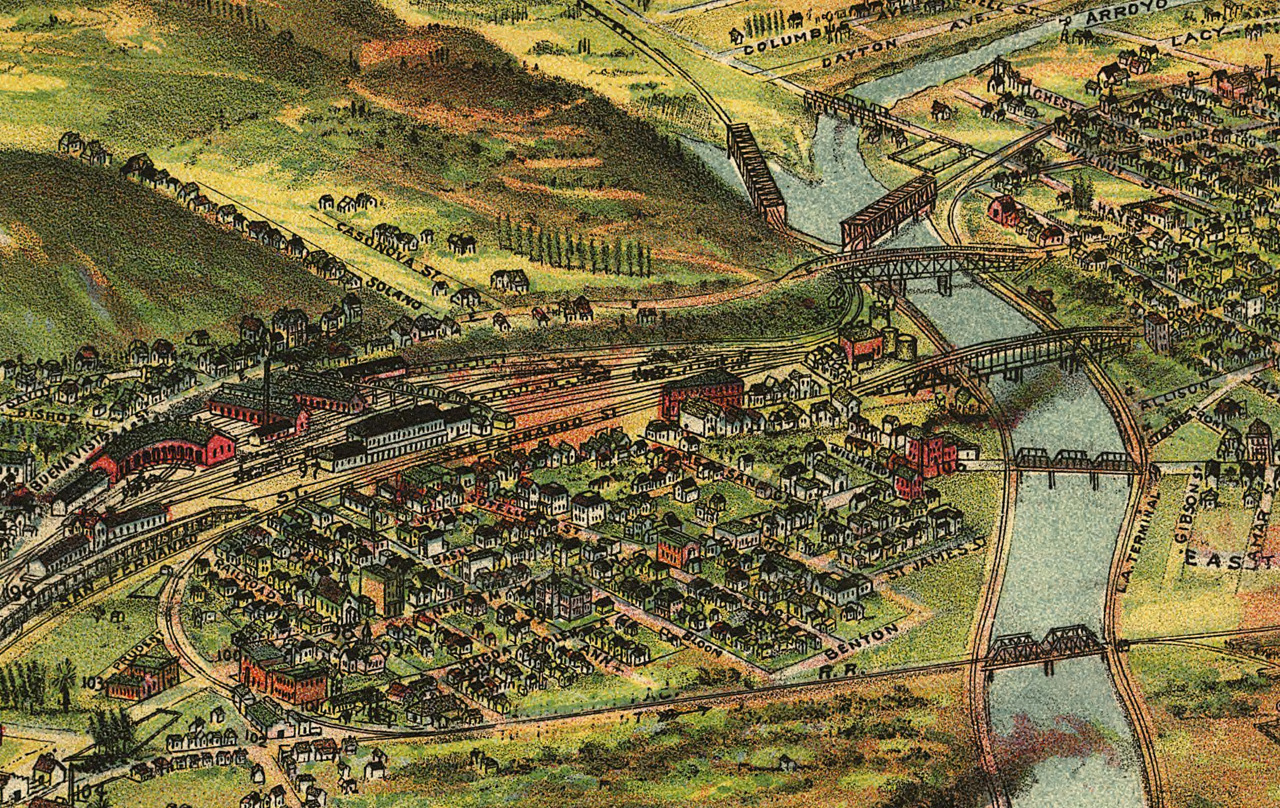
2. Map showing Tropico at a crossroads of rail, both local and national, 1903
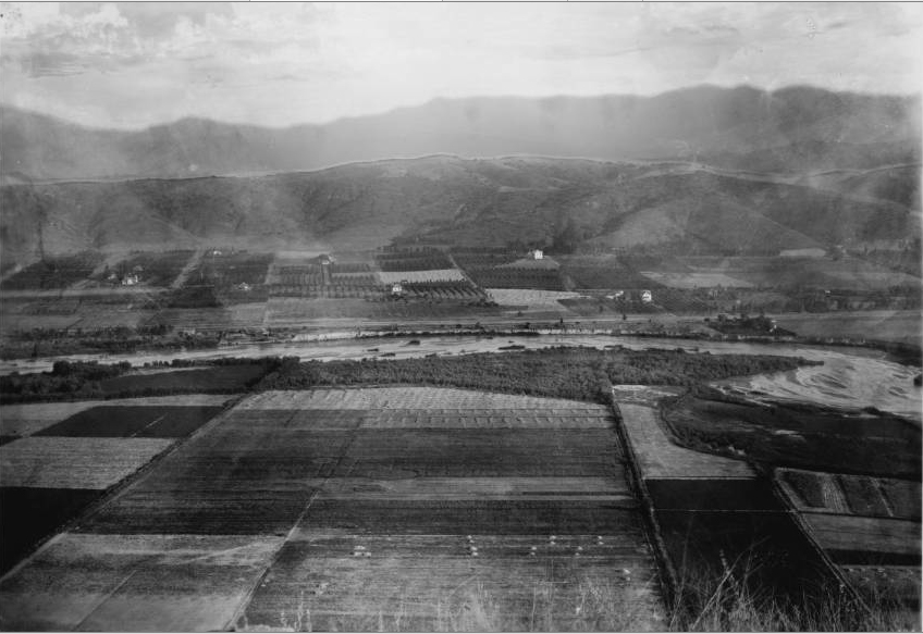
3. Farmland along the Los Angeles River, somewhere near Tropico
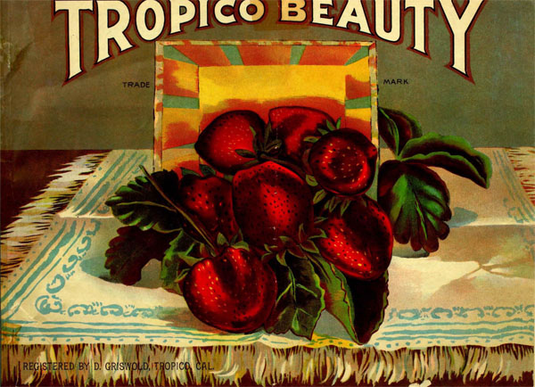
4. Tropico was famous for its strawberries, called “Tropico Beauties”
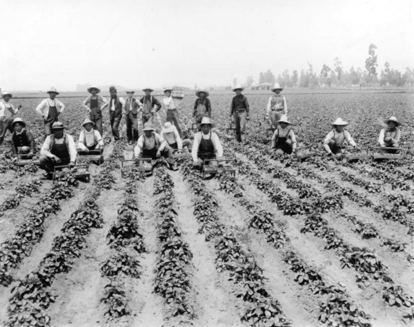
5. Farm workers on a Tropico strawberry field, ca. 1900
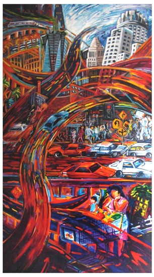
Rafael Escamilla, City
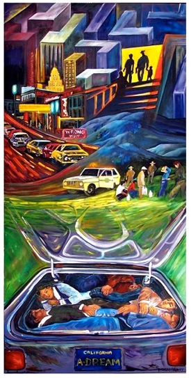
Rafael Escamilla, A Dream
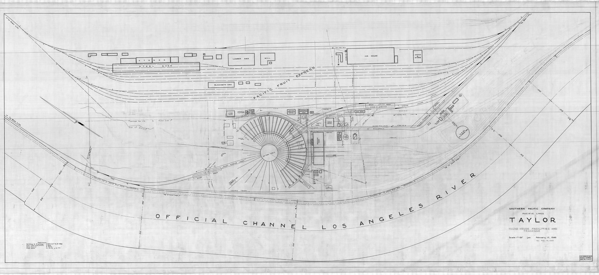
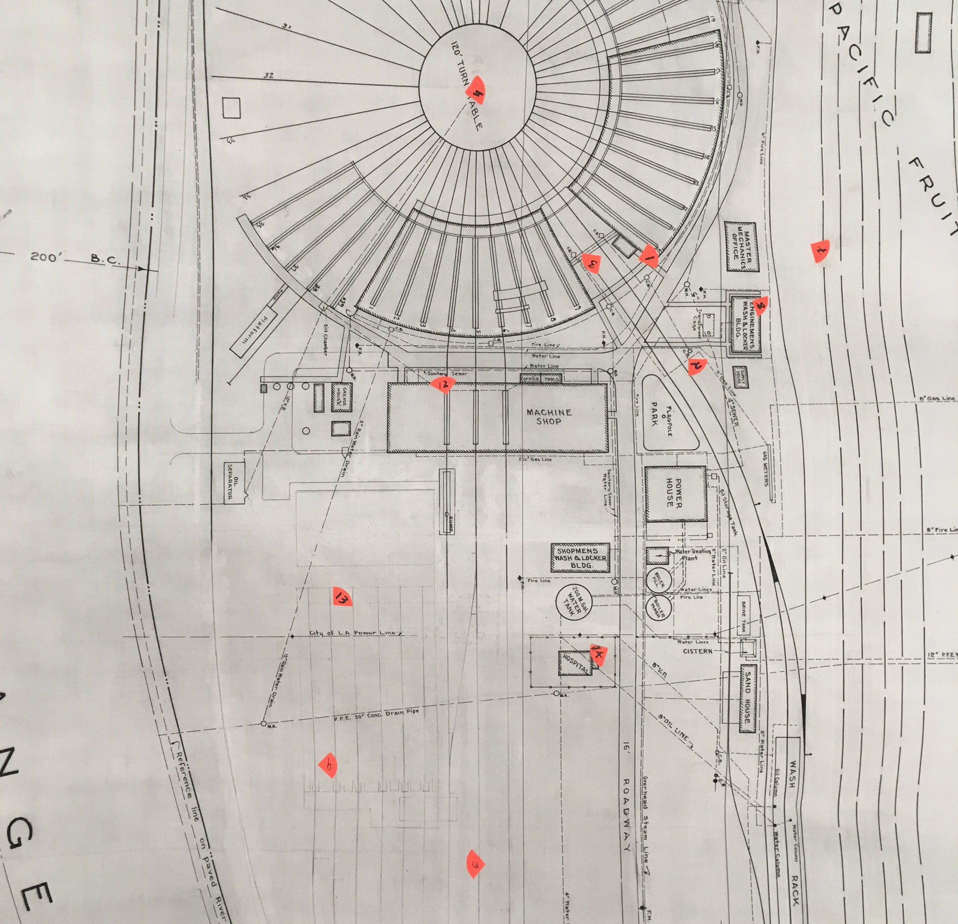
6. Plan of Taylor Yard, 1920
7. Detail of plan of Taylor Yard, 1920
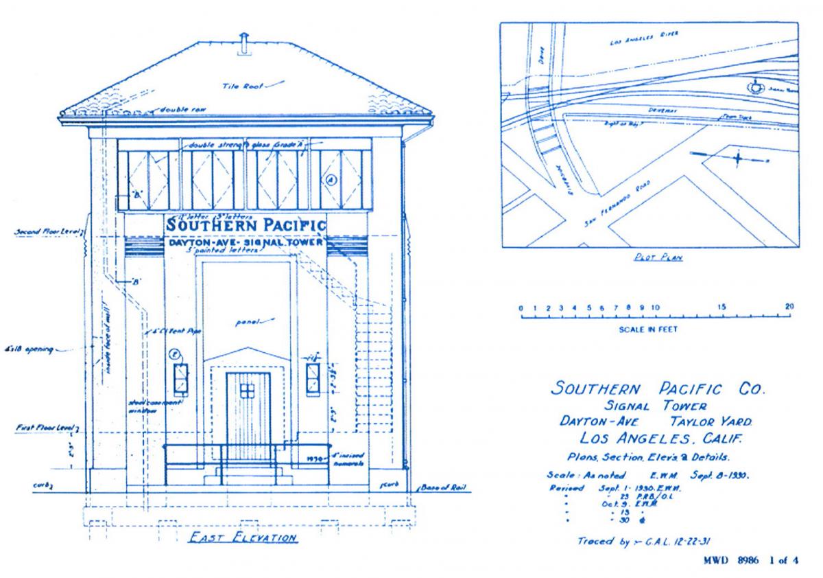
8. Dayton Avenue signal tower elevation, 1930
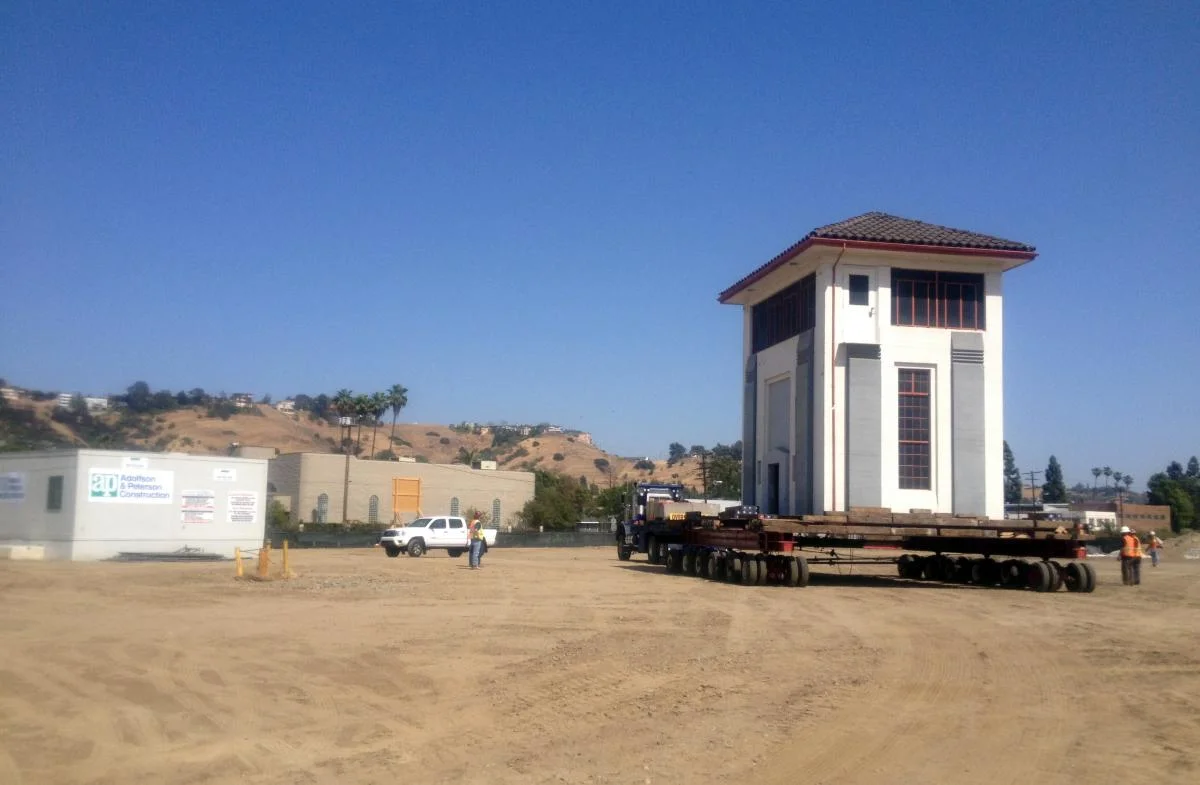
9. Dayton Avenue signal tower move
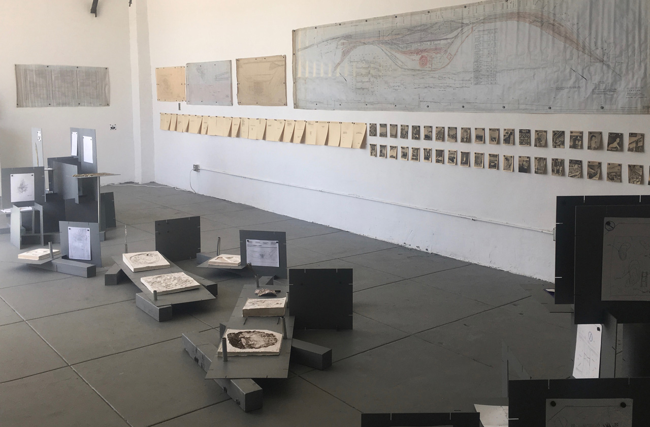
10. Roundhouse Platform’s Infrastructural Imaginary exhibit at 2426ww
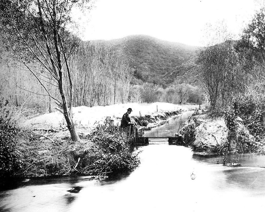
11. Taming the Los Angeles River, Glendale Narrows, 1896
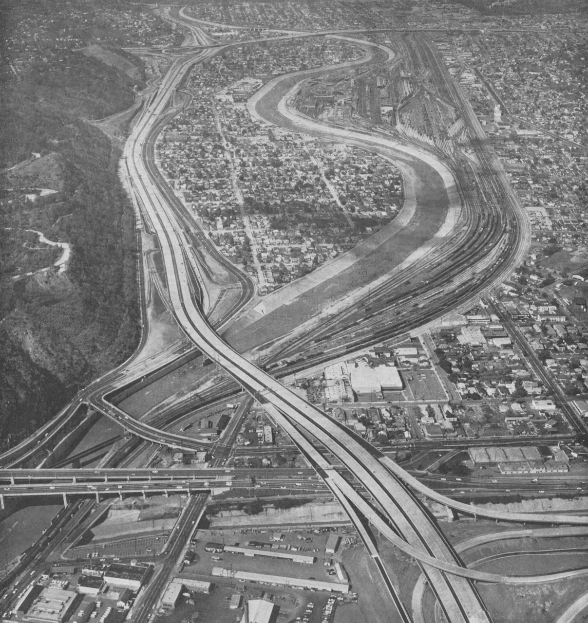
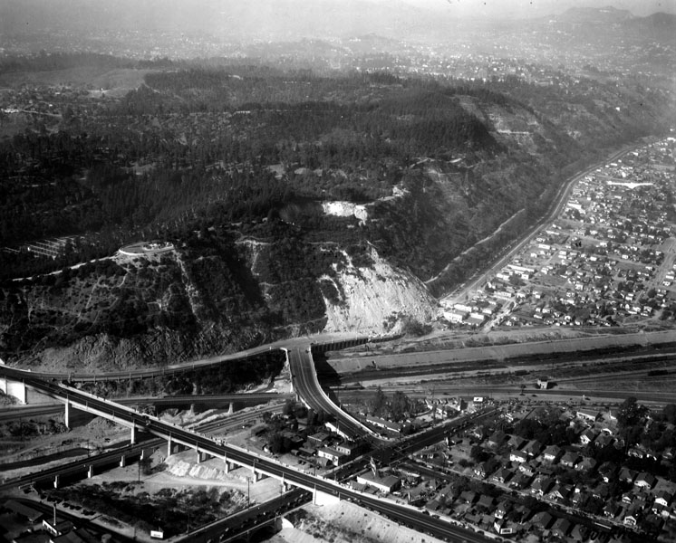
12. Aerial view looking up river just after Interstate 5 construction, 1962
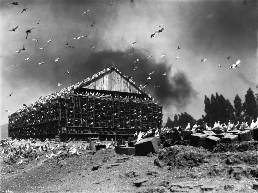
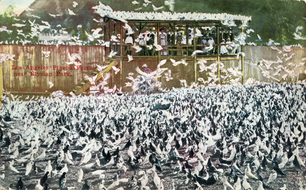
13. Pigeon Farm, ca. 1900
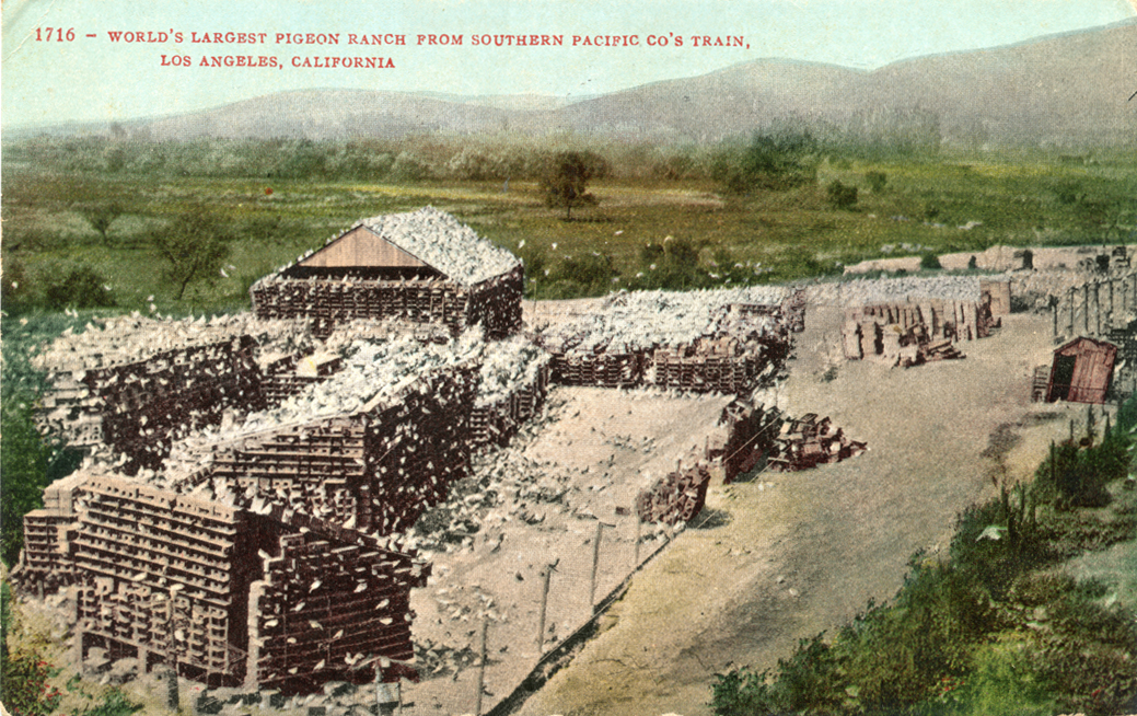
14. Postcard showing the view of pigeon farm from the train
15. The Pigeon Farm was a tourist attraction, 1911
16. View showing the precarious location of the Pigeon Farm
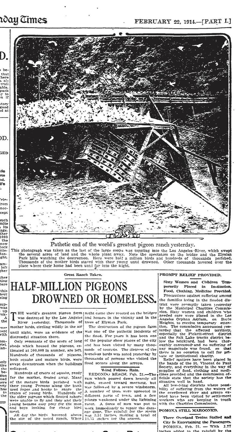
17. Newspaper coverage of the Pigeon Farm’s demise, 1914
18. Aerial view of the “incredible moving mountain” the morning after its collapse, 1937
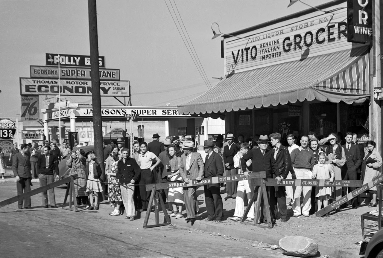
19. Spectators of the “incredible moving mountain” on Riverside Dr., 1937
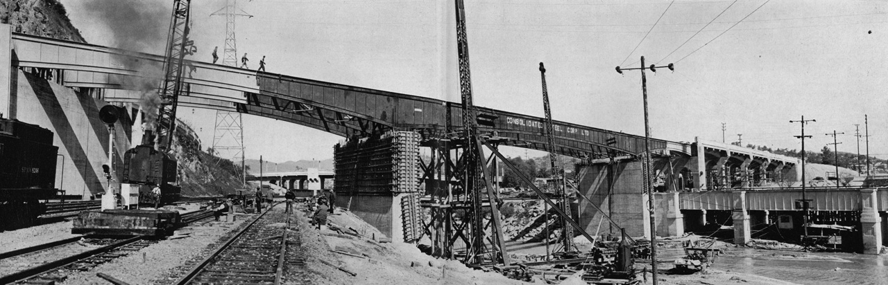
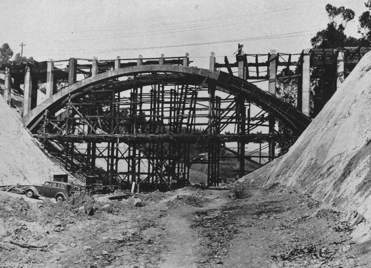
20. Constructing a bridge that would become part of the Arroyo Seco Parkway (the 110), 1937
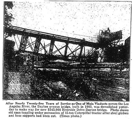
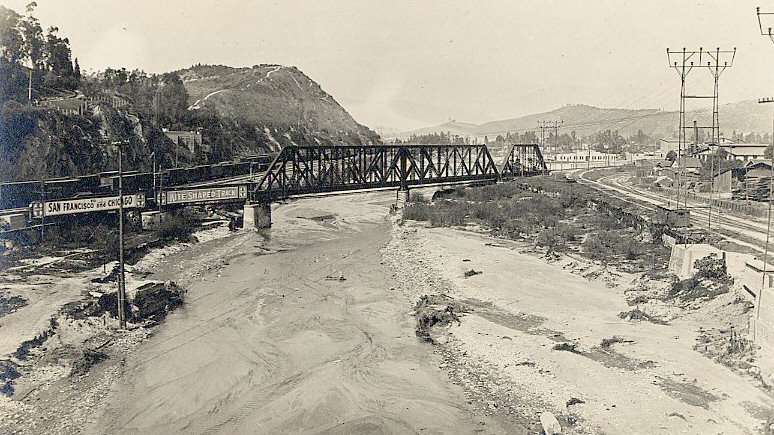
21. L.A. Times photo of the 1903 Dayton Avenue Bridge being demolished, June 17th, 1927
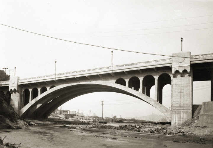
22. Dayton Avenue Bridge, 1928
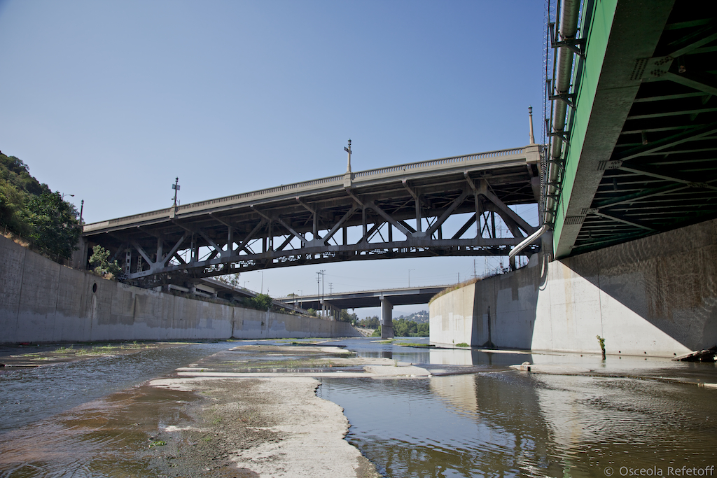
23. Riverside Drive Bridge, viewed from inside the Los Angeles River, 2011
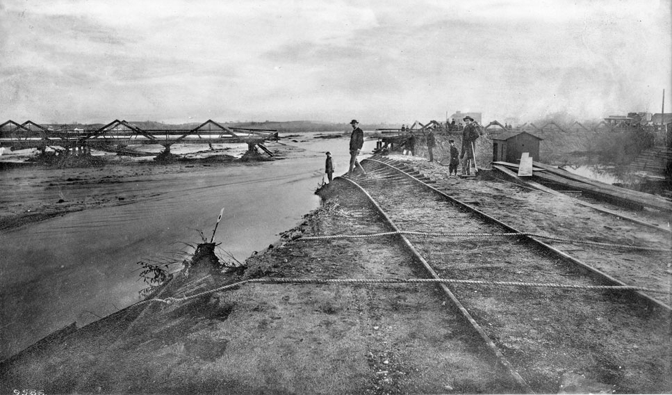
24. Flood damage south of the confluence, 1885
25. The new Arroyo Seco Parkway, walkway still under construction, 1944
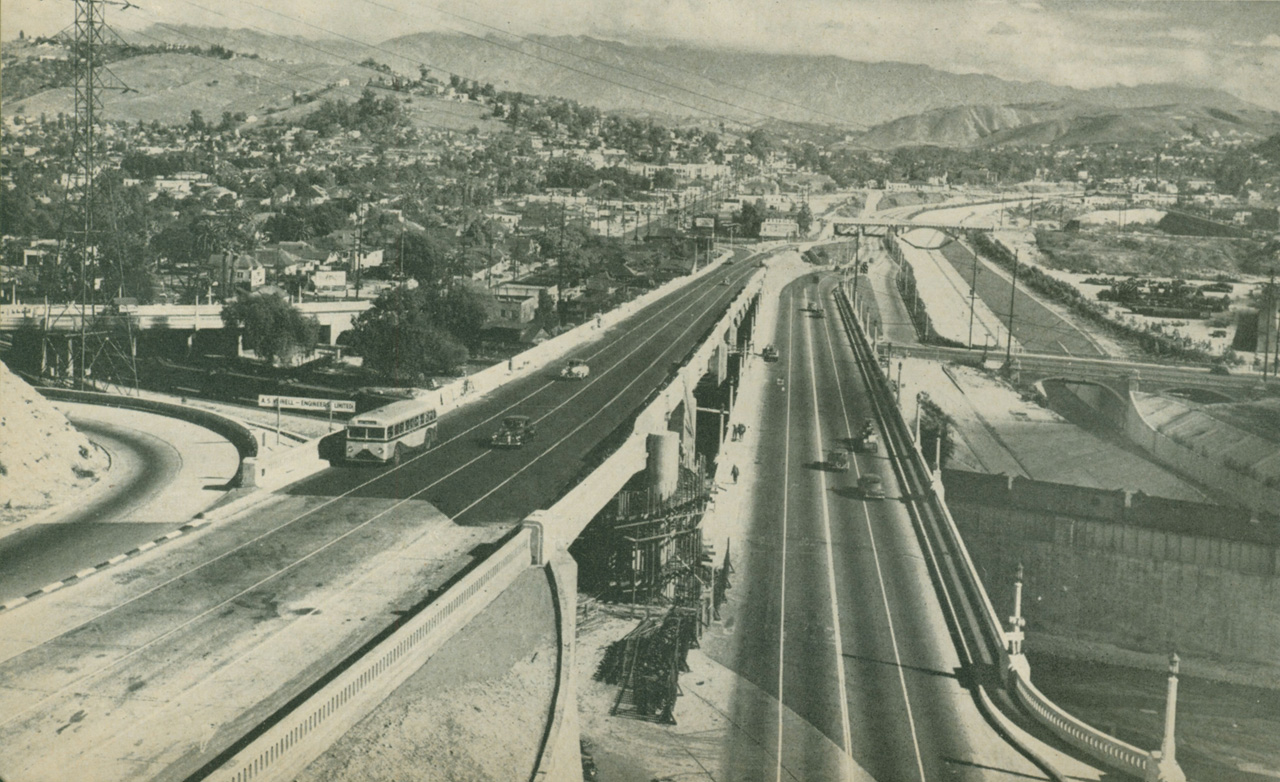
26. Freeway development in Elysian Park, 1940
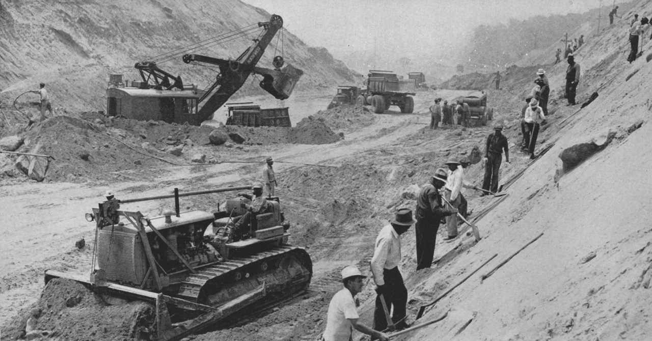
27. Removing a mountain for the Arroyo Seco Parkway, 1941
28. Park Row Dr. Bridge under construction, 1941
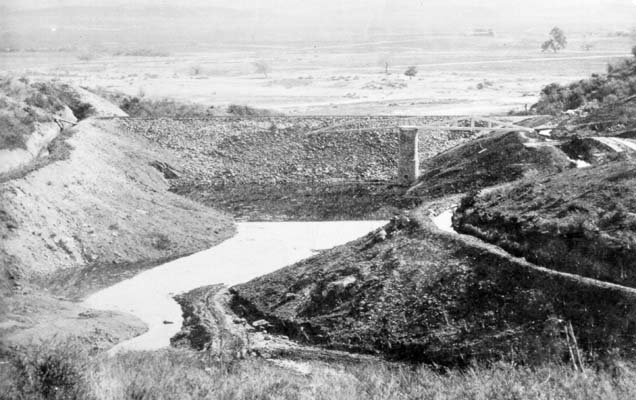
29. Buena Vista Reservoir, 1876
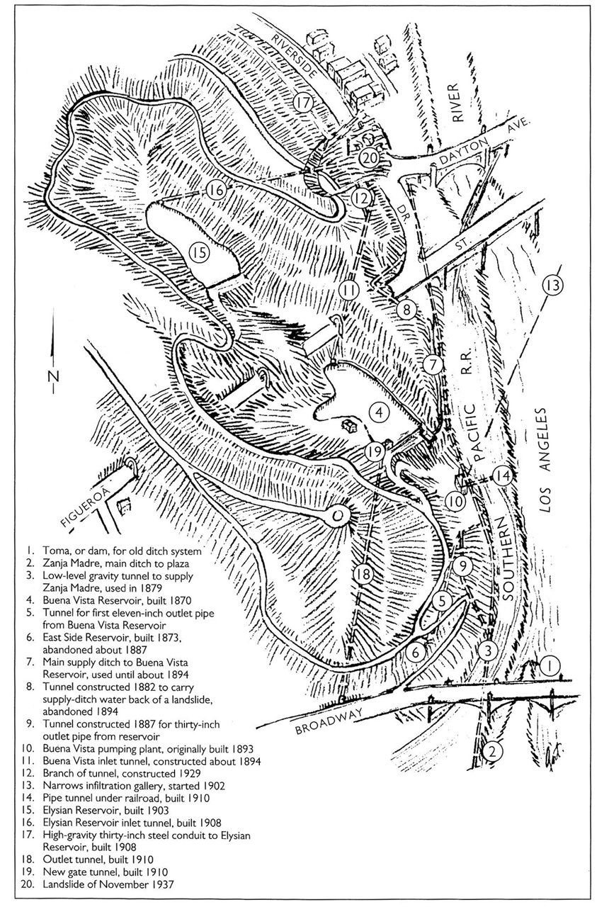
30. Waterworks in Elysian Park, 1937
31. View up the unchannelized River from the North Broadway Bridge, 1915
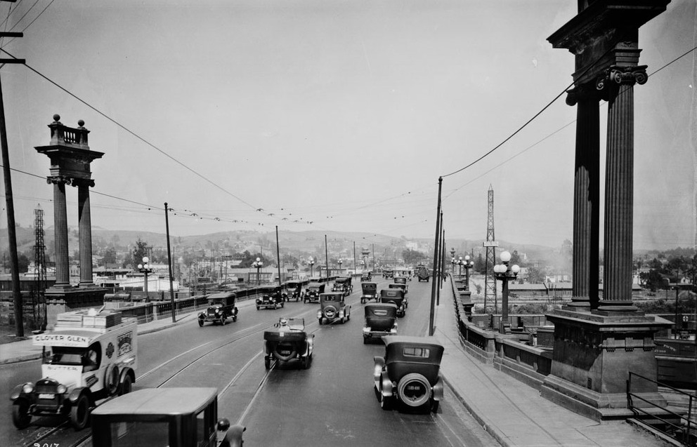
32. Traffic on the North Broadway Bridge, 1924
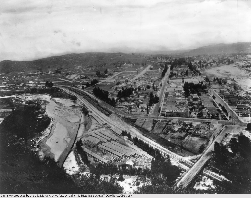
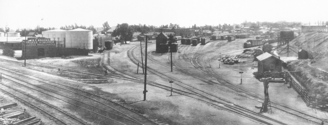
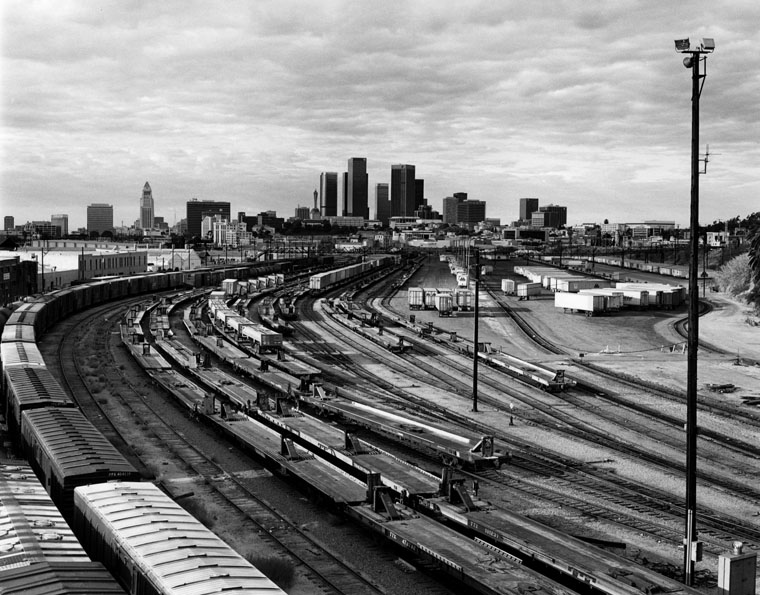
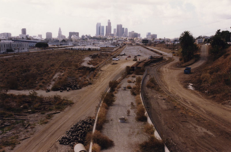
33. View of River Station from near what is now the North Broadway Bridge, 1900
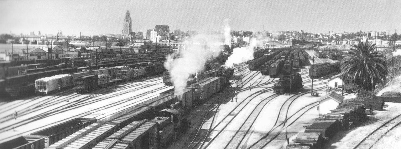
34. View of River Station from the North Broadway Bridge, 1953
35. View of River Station from the North Broadway Bridge, 1987
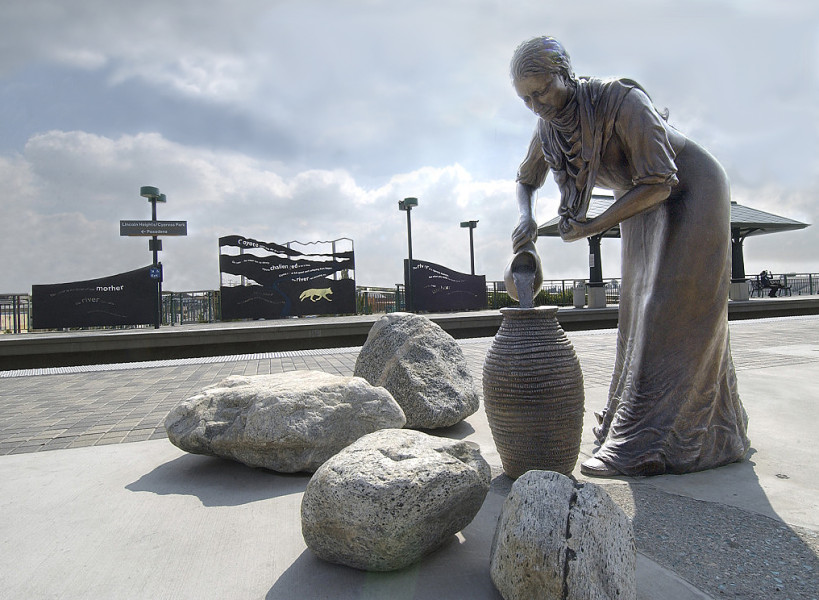
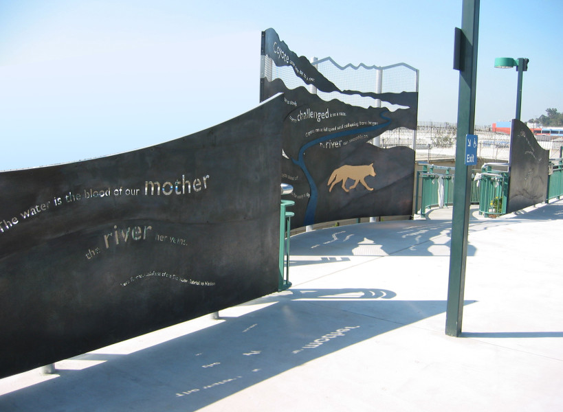
36. View of River Station site from the North Broadway Bridge, 2000
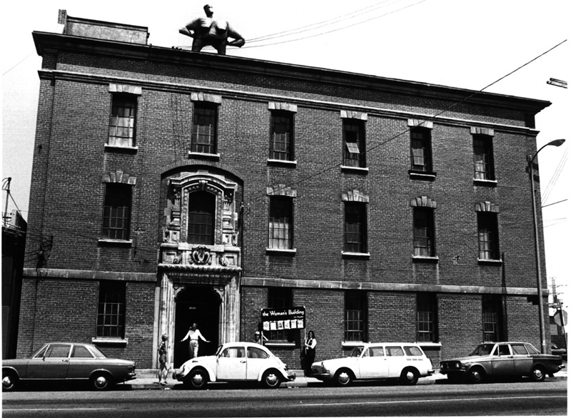
37. The Naked Lady, a sculpture by Kate Millet, stands proudly atop the Woman’s Building, 1980
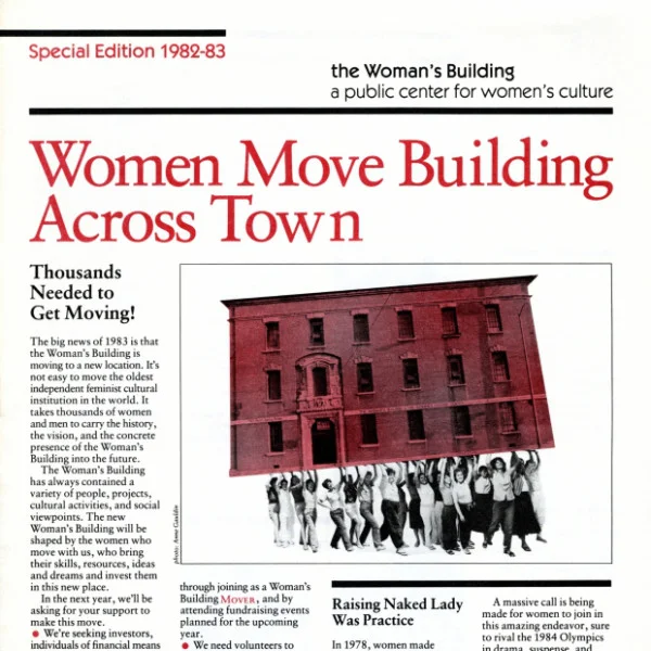
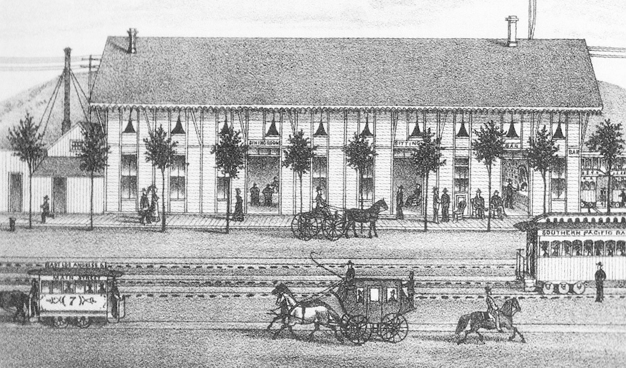
38. 1983
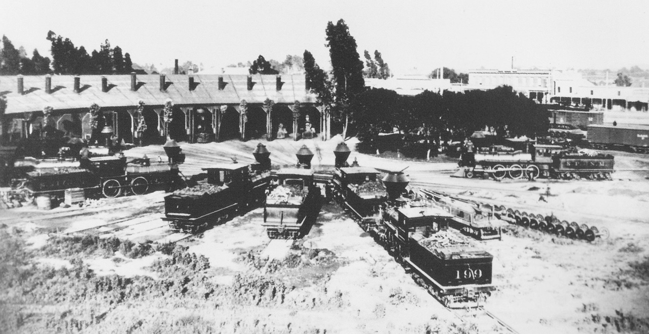
39. Cheri Gaulke’s Water Street: River of Dreams at Lincoln/Cypress Gold Line station, 2003
40. Cheri Gaulke’s Water Street: River of Dreams at Lincoln/Cypress Gold Line station, 2003
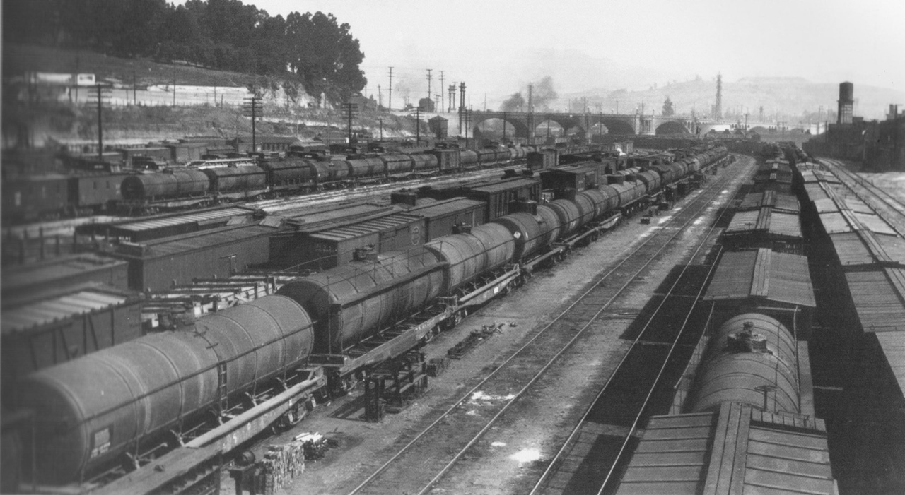
41. Hotel at River Station, 1876
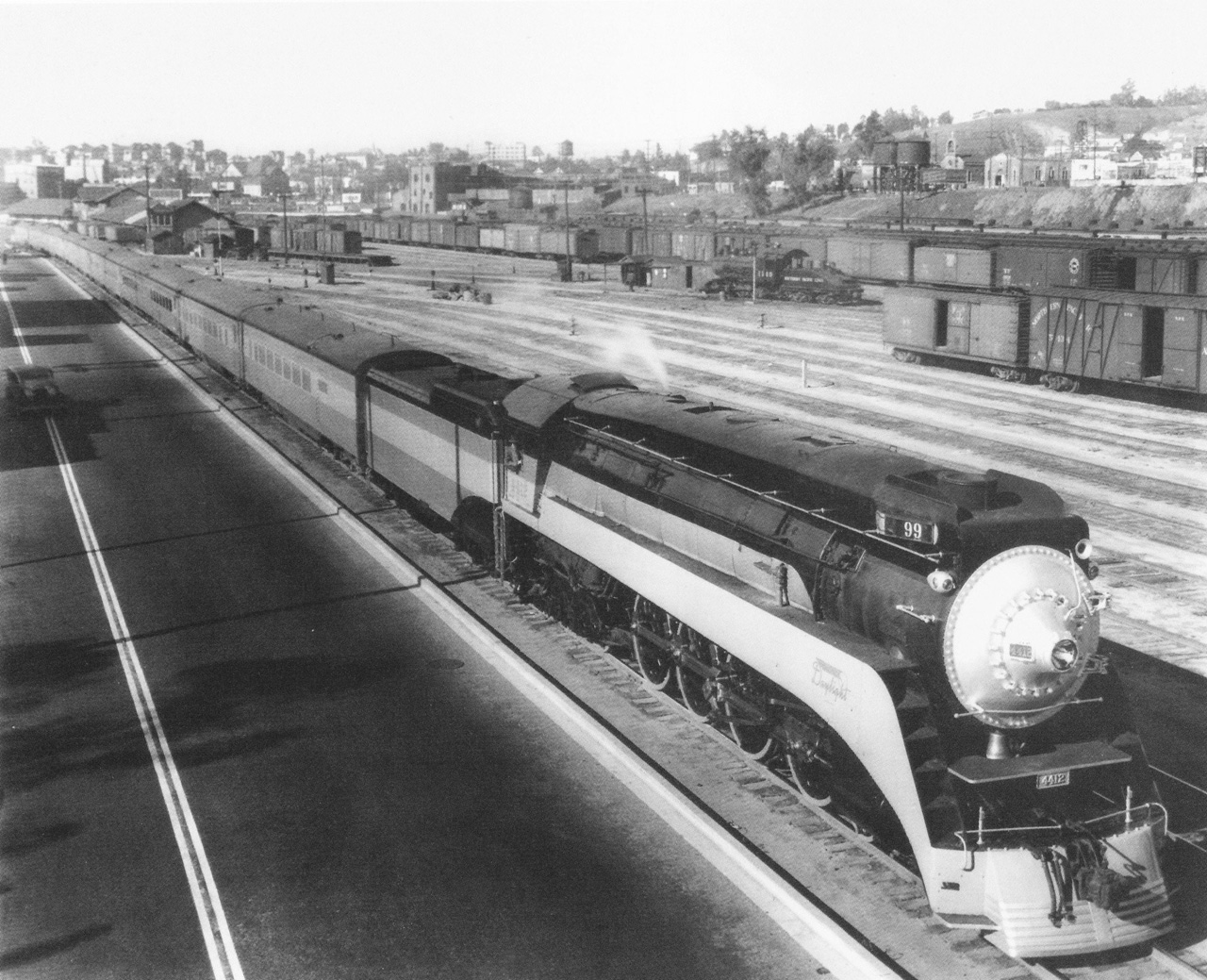
42. The roundhouse at River Station, ca. 1880s
43. Section of the Pierce Map showing the River Station area, 1894
44. Southern Pacific’s River Station Depot, looking towards the North Broadway Bridge, 1918
45. A Daylight locomotive at River Station Depot, adjacent to North Spring Street, 1937
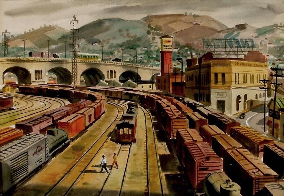
46. Painting of perspective from pedestrian bridge over River Station, 1947
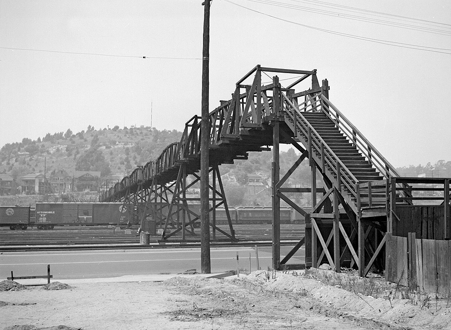
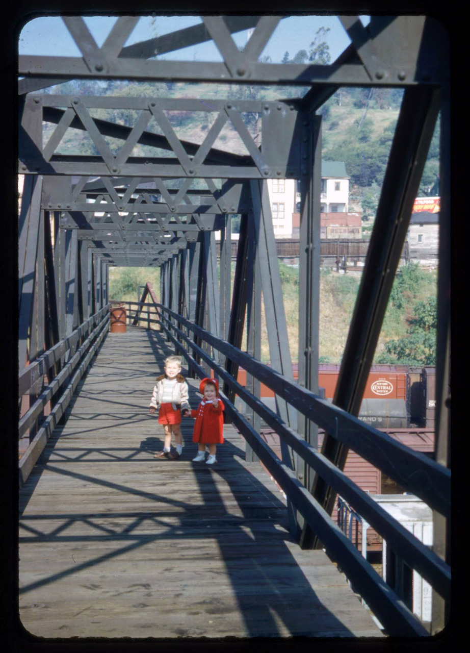
47. Pedestrian bridge over River Station
Pedestrian bridge over River Station